|
Report:
 Kirkwall
is geographically located around the middle of
the Orkney Islands which lay off the northern
coast of Scotland. We had many reasons to be excited
about the 11th leg of our around the world journey.
First and foremost, we were finally back over
land which means we can really begin to enjoy
our FScene
summer textures and take the flights lower
and slower to enjoy the beautiful scenery. Secondly,
we managed to pick up some Orkney brews at our
local market (special thanks to Rachel, who graciously
shares her expansive beer knowledge with us on
a weekly basis!). With The
Red MacGregor in our cooler, we pushed
back from the parking ramp in Kirkwall for our
VFR flight to Glasgow. VFR flight time based on
our flight planner was a few minutes shy of an
hour, but are going deviated a bit in order to
check out what Scotland had to offer. Kirkwall
is geographically located around the middle of
the Orkney Islands which lay off the northern
coast of Scotland. We had many reasons to be excited
about the 11th leg of our around the world journey.
First and foremost, we were finally back over
land which means we can really begin to enjoy
our FScene
summer textures and take the flights lower
and slower to enjoy the beautiful scenery. Secondly,
we managed to pick up some Orkney brews at our
local market (special thanks to Rachel, who graciously
shares her expansive beer knowledge with us on
a weekly basis!). With The
Red MacGregor in our cooler, we pushed
back from the parking ramp in Kirkwall for our
VFR flight to Glasgow. VFR flight time based on
our flight planner was a few minutes shy of an
hour, but are going deviated a bit in order to
check out what Scotland had to offer.
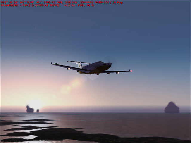
Acting
on a local’s tip, we opted for a 0400 departure
with light cloud scatter and no winds. (Note:
every Hopper flight is flown with real world weather
conditions. These conditions are further enhanced
with Flight1’s "Flight Environment"
add-on). We departed RWY 24 from Kirkwall with
the sun behind us and headed due south over what
remained of the Orkney’s.
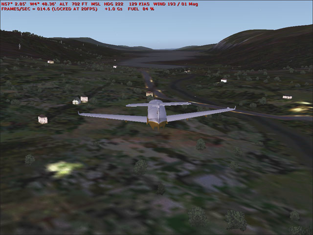 Once
over Scottish mainland, the people in the villages
below started to wake up and turn on the yellow
house lights which added some beautiful character
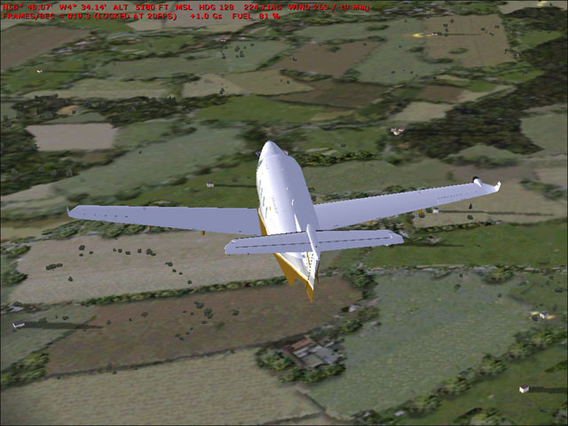
to the farmlands. We maintained 5,500 ft and enjoyed
the spectacular views of Scotland as the sun began
to rise and the different hue’s of green
in the land below began to take form. We headed
through a small bank of pink and purple clouds
over Moray Firth as we adjusted course and altitude
in order to head down the length of Loch Ness
in search of our underwater
ally. Many buildings and streets were
lit up as we headed through Inverness in the early
morning hours. The entrance to Loch Ness from
the North Sea begins with some S turns and some
mildly sloped cliffs and a few bridges here and
there. It as at this point that George took the
controls and I got out my binoculars as we headed
southwest. Once
over Scottish mainland, the people in the villages
below started to wake up and turn on the yellow
house lights which added some beautiful character
to the farmlands. We maintained 5,500 ft and enjoyed
the spectacular views of Scotland as the sun began
to rise and the different hue’s of green
in the land below began to take form. We headed
through a small bank of pink and purple clouds
over Moray Firth as we adjusted course and altitude
in order to head down the length of Loch Ness
in search of our underwater
ally. Many buildings and streets were
lit up as we headed through Inverness in the early
morning hours. The entrance to Loch Ness from
the North Sea begins with some S turns and some
mildly sloped cliffs and a few bridges here and
there. It as at this point that George took the
controls and I got out my binoculars as we headed
southwest.
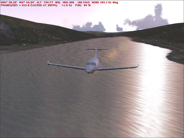 I
spotted a few Haggii
(plural for Haggis)
along the route but no sign of Nessie by the time
we reached what appeared to be a waterfall in
Loch with a small bridge beyond it. (Note: An
alcoholic drink derived from the haggis has yet
to be invented, despite many centuries of intensive
research.) This appears to be quite a slippery
slope for Lady Nessie. George put us in a high
banking turn and we circled the area wondering
if we might have missed something whilst we sipped
on the old Red
MacGregor. Meanwhile, I pulled out the
laptop and was surprised to find that one of the
small houses lit up near the water seemed to have
his wi-fi connection wide open! I connect quickly
and hit
up Google to see if what we thought we
be a dead ringer for a FS Easter Egg had been
spotted and reported. There
had been one sighting but even he was
a bit uncertain of whether it was part of a scenery
package he had installed or part of the default
FS config. We too started to wonder if our stellar
Flight Environment add-on from Flight1
might have overwritten a water texture. If you
have any details, or have spotted the Loch Ness
Monster in FS2004, please
drop us a line in our forums, hell even
if you haven’t stop by and have a drink with
us. I
spotted a few Haggii
(plural for Haggis)
along the route but no sign of Nessie by the time
we reached what appeared to be a waterfall in
Loch with a small bridge beyond it. (Note: An
alcoholic drink derived from the haggis has yet
to be invented, despite many centuries of intensive
research.) This appears to be quite a slippery
slope for Lady Nessie. George put us in a high
banking turn and we circled the area wondering
if we might have missed something whilst we sipped
on the old Red
MacGregor. Meanwhile, I pulled out the
laptop and was surprised to find that one of the
small houses lit up near the water seemed to have
his wi-fi connection wide open! I connect quickly
and hit
up Google to see if what we thought we
be a dead ringer for a FS Easter Egg had been
spotted and reported. There
had been one sighting but even he was
a bit uncertain of whether it was part of a scenery
package he had installed or part of the default
FS config. We too started to wonder if our stellar
Flight Environment add-on from Flight1
might have overwritten a water texture. If you
have any details, or have spotted the Loch Ness
Monster in FS2004, please
drop us a line in our forums, hell even
if you haven’t stop by and have a drink with
us.
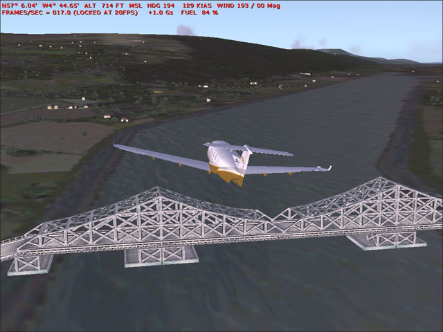 We
decided to head further down Loch Ness past the
waterfall, after all, maybe our underwater ally
prefers to stay more inland, such are the details
of a mystery. We spotted a nice bridge. Which
appeared to be steel and most likely only visible
to those who have installed the FS9.1 update which
adds many bridges that were missing in the original
release. We
decided to head further down Loch Ness past the
waterfall, after all, maybe our underwater ally
prefers to stay more inland, such are the details
of a mystery. We spotted a nice bridge. Which
appeared to be steel and most likely only visible
to those who have installed the FS9.1 update which
adds many bridges that were missing in the original
release.
 Eventually,
we turned south and climbed to 3,800 feet and
seemed to spot what appeared to be some white
lettering in the countryside but couldn’t
make the words out. Looked like SME, but the rest
was unintelligible. With the sun higher in the
sky, the farm land texture below was just outstanding,
I think I even spotted some sheep! Eventually,
we turned south and climbed to 3,800 feet and
seemed to spot what appeared to be some white
lettering in the countryside but couldn’t
make the words out. Looked like SME, but the rest
was unintelligible. With the sun higher in the
sky, the farm land texture below was just outstanding,
I think I even spotted some sheep!
Closer
to Glasgow around 0513 the clouds were thicker
and visibility was poor. On approach we even passed
through a small patch of rain, but we were soon
out of it with a few miles left on final. Our
approach to RWY 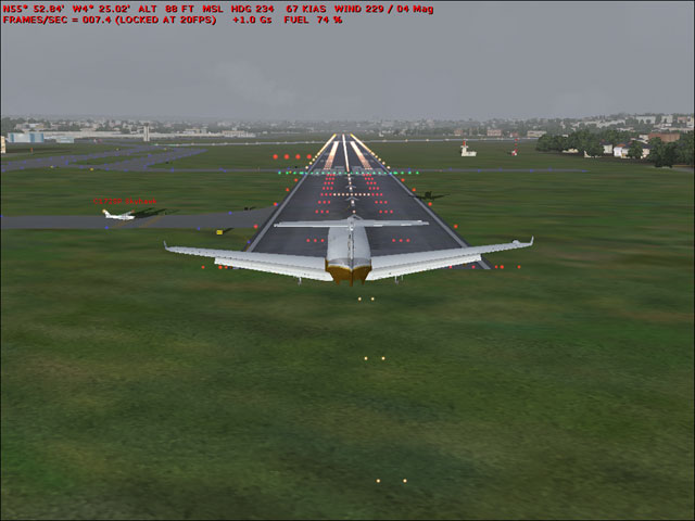 19
in Glasgow had some mild winds from 229 at 4,
and a 172 holding short which was a relief after
our issues with a Cessna suddenly taking off in
front of us when we were landing in Nuuk, Greenland
(screencap link). We taxied to parking, turned
off the engine and opened the main exit and quickly
found a good spot to set up the Inflatable Pub.
Sure it was only 0530, but bloody hell we’re
in Scotland and we’ve got some fine brews
in these parts. Bottoms up! 19
in Glasgow had some mild winds from 229 at 4,
and a 172 holding short which was a relief after
our issues with a Cessna suddenly taking off in
front of us when we were landing in Nuuk, Greenland
(screencap link). We taxied to parking, turned
off the engine and opened the main exit and quickly
found a good spot to set up the Inflatable Pub.
Sure it was only 0530, but bloody hell we’re
in Scotland and we’ve got some fine brews
in these parts. Bottoms up!
GB
|